Ireland. Department of Health. (2026) Overview of the new health geographies.
External website: https://www.gov.ie/en/department-of-health/publica...
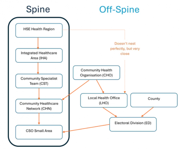
This page provides an overview of the new health geography hierarchy used across the health system. It outlines how to access boundary files, explains why these geographies matter, and shows how the different levels fit together.
All geographies are hierarchical. Just as counties nest within provinces, and provinces nest within the country, the new health geographies nest within each other. The new health geographies are on the “spine.” These are the geographies that are on the centreline, starting with “HSE Health Regions.” These geographies nest perfectly within each other, from CSO Small Areas up to the HSE Health Regions. Geographies that are “off-spine” do not nest within the hierarchical structure of the new health geographies.
CSO Small Areas are the smallest level of geography you can get basic demographic data for, such as total population by age, sex, and race. The CSO release Census data at this level, known as Small Areas Population Statistics (SAPS). Therefore, CSO Small Areas are used as the 'building blocks' of official geographies.
See the Department of Health website for more information.
Repository Staff Only: item control page